In my presentation, I will firstly introduce about the University of Science and Technology of Hanoi (USTH, also called Vietnam-France University). USTH is a public university, established in 2009 under the Intergovernmental Agreement between Vietnam and France with the aims to be a leading research-oriented university at an international standard in Vietnam.

Next, I will provide an overview of meteorological hazards and climate change modeling activities in Southeast Asia, along with recent downscaling activities using the Coupled Model Intercomparison Project Phase 5 (CMIP5) and Phase 6 (CMIP6). Southeast Asia is currently home to 8.6% of the world’s population, and any changes in the climate system can significantly impact the region’s socio-economic structures and living conditions. Given the high exposure and vulnerability of the region to extreme events, countries in Southeast Asia need to implement adaptation measures to mitigate risks. Therefore, there is a critical need for detailed information on future climate scenarios in the region. However, such information is still lacking in the region and often derived from global climate models (GCMs) that may have large uncertainties in a complex area like Southeast Asia. In order to fill the gap, the Coordinated Regional Climate Downscaling EXperiment – Southeast Asia (CORDEX-SEA) project was established and successfully brought together members from several countries to carry out a high-resolution, multi-model regional climate downscaling experiment. Additionally, several statistical downscaling efforts have been conducted. We address how the simulation of present-day extremes is influenced by various choices in physical parameterizations, aiming to identify schemes well-suited for simulating the climate in the region. Subsequently, we analyze the future projected mean climate and extreme conditions in Southeast Asia.
Lastly, I will elaborate on some ideas for potential collaboration opportunities in both training and research topics.
Dr. Thanh Ngo-Duc received his engineering diploma and Master degree from the Ecole Polytechnique (France) in 2001 and 2002, respectively. He obtained his Ph.D. in Meteorology from University of Paris VI in 2005. His Ph.D. thesis was awarded the silver medal of the Academy of Agriculture of France, and the Nathalie DEMASSIEUX prize of the Chancellery of the Universities of Paris in 2006.
Dr. Thanh Ngo-Duc is currently Co-Director of the Department of Space and Applications (DSA), and Co-Director of the LOTUS International Joint Laboratory (http://lotus.usth.edu.vn) at the University of Science and Technology of Hanoi (USTH).
He is currently the Chairman of the Scientific Committee in Earth and Environmental Sciences of the Vietnam National Foundation for Science and Technology Development (NAFOSTED).
He is the lead author of the Sixth Assessment Report (AR6) of IPCC (2021).
Using modeling and remote sensing tools, his research focuses on the topics of natural disasters and climate change. He has been responsible for the climate work package of the project GEMMES Vietnam funded by AFD (2018-present).
Contact: Thanh NGO-DUC, Assoc. Prof.
Co-Director, Department of Space and Applications,
University of Science and Technology of Hanoi,
Vietnam Academy of Science and Technology
18 Hoang Quoc Viet, Cau Giay, Hanoi, Vietnam
Email: ngo-duc.thanh@usth.edu.vn
Google scholar: https://scholar.google.com/citations?user=RivfmqAAAAAJ
6 mars 2024 – 13h
À lire aussi
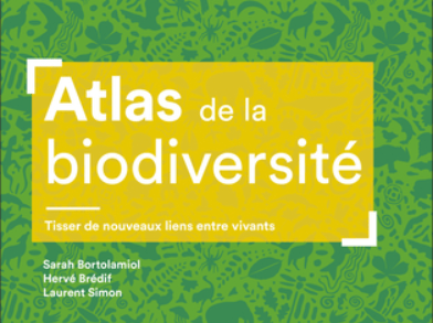
Prochain midi de Géotéca : Présentation de l’Atlas de la biodiversité – jeudi 28 mai à13h
Sara Bortolamiol et Hervé Brédif présentent l’Atlas de la biodiversité – Tisser de nouveaux liens entre les vivants, co-écrit avec Laurent Simon et publié aux éditions Autrement. Ils viennent présenter leur approche méthodologique dans la réalisation de l’atlas et le...
Fiche projet type
Période de réalisation Référente à Géotéca Cathy Chatel – Ingenieure de recherche en Sciences de l’information géographique Personnes impliquées et laboratoire Financement Description Missions Géotéca dans ce projet, type de rendus Références ou publication...
Commodifying land : capital, inequalities and conflicts in sub-saharan African metropolitan peripheries
Ce projet porte sur les nouvelles inégalités territoriales induites par les dynamiques métropolitaines dans trois capitales est-et ouest-africaines (Nairobi, Bamako et Dakar) en prenant le foncier et sa valorisation comme clé d’entrée. Les périphéries de ces villes,...
Le peuplement mexicain : entre structures spatiales résilientes et dynamiques actuelles
Lorem ipsum Dolor sit amet, consectetuer adipiscing elit, sed diam nonummy nibh euismod tincidunt ut laoreet dolore magna aliquam erat volutpat. Ut wisi enim ad minim. © Lorem ipsum dolor sit amet, consectetuer adipiscing Période de réalisation 2025 - 2026 Référente à...